iHEER Instructions-Draft
Before using iHEER for the first time, read the Instructions and Limitations below.
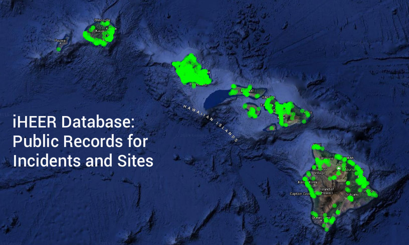
Go to Viewer Map Want to Know What’s in iHEER?
 Incidents
Sites
HEPCRA
Public Record Request
Incidents
Sites
HEPCRA
Public Record Request
iHEER can be used to obtain public records and is user-friendly but has some limitations. Please read the following instructions to learn how you can use iHEER to obtain public records and get further information.
Alternatively, you may continue to fill out a Public Record Request and submit it to HEER through e-Permitting. If you need help, please contact the HEER Office.
INCIDENTS, also called Spills or Releases, include emergency responses and initial release notifications. Incidents are hazardous substance releases overseen by State On-Scene Coordinators in the EP&R Section.
SITES are contaminated or potentially contaminated areas overseen by State Remedial Project Managers in the SDAR Section.
HEPCRA (Hawaii Emergency Planning and Community Right-to-Know Act) includes chemical storage information submitted on Tier II forms. The Community Right-to-Know provisions help increase the public’s knowledge and access to information on chemicals at individual facilities, their uses, and releases into the environment.
VIEWER Use the Viewer Map to find Incidents or Sites in the vicinity of a location of interest.
- Sites that are marked FOR PUBLIC?=No won’t not show in Lists nor on the Viewer Map. For Navy sites, a request for public record must be made to HEER and cleared by the Navy before the office can provide documents.
- Incidents that are still Open (as opposed to Referred or NFA’d) will not show in Lists nor on the Viewer Map.
- Incidents occurring before July 1, 2015 are not yet in iHEER.
- For HEPCRA facilities that are marked Sensitive, documents must be requested.
- Documents that are marked For Public?=No won’t show in the Document List.
- Titles of Documents that are marked By Request will show in the Documents List but the file must be requested.
Instructions on iHEER Features and Limitations
| PUBLIC AVAILABLITY MATRIX in iHEER VIEWER PANEL LIST and MAP, INCIDENTS, SITES and HEPCRA |
||||||||||||||||||||||||||||||||||||||||||
| Incidents | ||||||||||||||||||||||||||||||||||||||||||
|
||||||||||||||||||||||||||||||||||||||||||
| Sites | ||||||||||||||||||||||||||||||||||||||||||
|
||||||||||||||||||||||||||||||||||||||||||
| HEPCRA | ||||||||||||||||||||||||||||||||||||||||||
|
||||||||||||||||||||||||||||||||||||||||||
| Feature | Comment | Limitation | ||||||||||||||||||||||||||||||||||||||||
| No login is required for public access to iHEER. | We’re continually updating information in iHEER. | |||||||||||||||||||||||||||||||||||||||||
| There are four publicly available Modules in iHEER: Viewer, Incidents, Sites and HEPCRA. | ||||||||||||||||||||||||||||||||||||||||||
1. Viewer
Use the Viewer to find Incidents or Sites in the vicinity of a location of interest. Zoom in on the Viewer Map to your location of interest, or, type in the address to zoom to your location of interest and see Markers for nearby Incidents or Sites.
| Feature | Comment | Limitation |
| Incidents occurring on or after July 1, 2015 + Status Referred or NFA’d + assigned a latitude/longitude will have a Marker on the Viewer Map and the Viewer Panel List. | The most recent 1000 Incidents occurring on or after July 1, 2015 + Status Referred or NFA’d + NOT assigned a latitude/longitude will be included in the Viewer Panel List with a No Location note. | Incidents occurring before July 1, 2015 OR Status Open + whether or NOT assigned a latitude/longitude will NOT be included in the Viewer Map nor in the Viewer Panel List. |
| Sites occurring on any date + with any Status + marked For Public view + assigned a latitude/longitude will have a Marker on the Viewer Map. | Sites occurring on any date + with any Status + marked For Public view + NOT assigned a latitude/longitude will be included in the Viewer Panel List with a No Location note. | Sites occurring on any date + with any Status + marked NOT For Public view + whether or NOT assigned a latitude/longitude will NOT be included in the Viewer Map nor in the Viewer Panel List. |
| HEPCRA Facilities from any date + Sensitive or Not + assigned a latitude/longitude will have a Marker on the Viewer Map. | The first 1000 alphabetically will be displayed. | HEPCRA Facilities from any date + Sensitive or Not + NOT assigned a latitude/longitude will not be included in the Viewer Map but will be included in the Viewer Panel List with a No Location note. |
| GETTING A MAP OF INCIDENTS, SITES or HEPCRA | ||
| The Viewer Panel on the Viewer has separate Tabs for Incidents and Sites. | Switch between Tabs to view. | Incidents and Sites can’t be viewed together. |
| The Viewer Map displays publicly available Incidents, Sites or HEPCRA Facilities that have been assigned a latitude/longitude. | For Sites, by default, the Viewer Map displays Site Centroids only. It takes the page about 7 seconds to load. | Incidents or Sites that have NOT been assigned a latitude/longitude will NOT be included on the Viewer Map, but will be included in the Viewer Panel List with a No Location note. Incidents are limited to the most recent 1000. HEPCRA facilities are limited to the first 1000 alphabetically. |
| There are about 55 Sites with no location and therefore no Site Centroid to display on the Viewer Map. For some Sites, no location information is included in the record, as there are no documents or there are no landmarks in the maps provided. | Other reasons for missing Site Centroids are that the record: is Administrative, covers a Group of sites that have location information in their individual records, is a Honolulu Harbor Request for Information, or is a Building or Pier with no address. | Sites with no Site Centroid will NOT be included on the Viewer Map, but will be included in the Viewer Panel List with a No Location note. |
| About 47% of Incidents have no location and therefore no Marker to display on the Viewer Map. | Incidents with no location will be included in the Viewer Panel List with a No Location note. | Incidents with no location will NOT be included on the Viewer Map. The Viewer Panel List and Viewer Map are limited to the most recent 1000 incidents. |
| The Viewer will load a Marker on the Viewer Map for each publicly available Incident/Site/HEPCRA Facility that has been assigned a latitude/longitude. | Once you’ve landed on the Viewer page, allow about 7 seconds for Incident/Site Markers to appear. | For searches in the Viewer Keywords Search Box, wait for the page to load, then type in the keyword. Be patient! Attempting to search before the Markers are loaded may result in an incorrect result. If the list refreshes and the results don’t look right, hit Refresh Page. |
| GETTING MORE DETAILS ON INCIDENTS, SITES or HEPCRA | ||
| Markers are clickable. Clicking Markers (Incidents: Orange Dots with Blue inverted Droplets, Sites: Green Dots or HEPCRA: Green Dots with Blue inverted Droplets) takes you to a Summary Page. | Navigate to further information about the Incident or Site by clicking the Details Button. | If you navigate to the Details Page, you’ll have to reenter your search. |
| FILTERING/SEARCHING INCIDENTS, SITES or HEPCRA | ||
| Incidents may be filtered/searched using the Viewer Keywords Search Box on the Incidents Tab. | Incidents without a location (NOT assigned a latitude/longitude) will be returned by the search and included on the Viewer Panel List with a “No Location” note. | Incidents without a location will NOT be included on the Viewer Map. |
| Sites may be filtered/searched using the Viewer Keywords Search Box on the Sites Tab. | Sites without a location (NOT assigned a latitude/longitude) will be returned by the search and included on the Viewer Panel List with a “No Location” note. | Sites without a location that are returned by the search will NOT be included on the Viewer Map. “No Location Information” is also noted under Details–>Location Description. |
| A Location Type Dropdown can be found along the top of the Viewer. | Location Types for Sites include: Site Centroid, Site Boundary, Site Feature (point, line and polygon), Management Area, and the Controls: CEHMP, EHMP/IC/LUC, AEHMP and NFAIC. | |
| There are two methods for Filtering/Searching Sites requiring Institutional/Engineering controls, by Control Type Polygon and by Status. | The Status of a Site is connected with the Document Type, not the Control Type Polygon. | So it’s possible for the Status and the Control Type to disagree. |
| Method 1-Filtering/Searching Sites requiring Institutional/Engineering controls by Control Type Polygon: Sites with Institutional/Engineering controls can be searched using the Controls? Dropdown on the Viewer Sites Tab. Choose Yes in the Controls? Dropdown. | Only Sites with Location Types of CEHMP, EHMP/IC/LUC, AEHMP and NFAIC will be included. Sites without a Controls Type Polygon won’t be listed. | But every site that requires a control may not have a Controls Type Polygon. See Method 2. |
| Method 2-Filtering/Searching Sites requiring Institutional/Engineering controls by Status: Sites with Institutional/Engineering controls can also be searched in Sites–>Status for “Remedy Needed”, “Remedy Selected”, “Remedy In Place”, and “NFA w/ICs”. | Document Types that were assigned between when the Sites were imported and when the Status was updated with the status from Access are not reflected in the overall Status. They are accounted for in the spreadsheet Sites From iHEER, Updated 02/22/2022. | |
| ZOOMING IN AND OUT ON THE VIEWER MAP | ||
| You can zoom into a specific island with the “Zoom To” button at the top right of the page. | Zoom further into the area of interest by using the “+” button on the top right of the page. Or Zoom in by using your computer mouse wheel. | |
| There are a few Sites in iHEER that are not within state borders. | Zoom out using the “-” button on the top right of the page to see them on the Viewer Map. Or Zoom out by using your computer mouse wheel. | |
| You can also Zoom to addresses whether they’re in the database or not. To search for Incidents/Sites in the vicinity of a specific area, use the Address Search Bar on the top right of the Viewer Page. Type your address so that a valid match appears below the search bar (in blue, with white bars at the top and bottom), select the valid address, click the magnifying glass, and the Viewer will zoom to the address. | Markers for surrounding Incidents or Sites will be visible. | Make sure to clear the Keywords Search Bar in the blue Viewer Panel first to avoid filtering away Sites/Incidents in the vicinity of the address of interest. |
2. Incidents
Use the Incidents module to filter/search a list of Incidents by keywords.
| Feature | Comment | Limitation |
| WHAT THE ON-LINE RECORD INCLUDES FOR INCIDENTS | ||
| The online record for each Incident includes Details, Locations, Substances, and Documents. | ||
| DOCUMENTS AVAILABLE FOR INCIDENTS | ||
| Documents for Referred or NFA’d Incidents occurring on or after July 1, 2015 may be downloaded online directly from iHEER. | Documents for Open Incidents are not available online. | To see the documents for Open incidents, please fill out a Public Record Request and submit it to HEER through e-Permitting. |
| FILTERING/SEARCHING INCIDENTS | ||
| There are two methods for Filtering/Searching on the main Incidents page, Method 1: the Keywords Search Box at the top of the main Incidents page and Method 2: the Advanced Search Button (top right of the page). | The Advanced Search Button has additional Filtering/Searching columns (18) compared to the Search Boxes (8) under the Sortable Column Headings. | Caution: The Search Boxes under the Sortable Column Headings on the main Incidents page, only filter what is returned from the server and displayed, so only those first 1000 will be filtered. For example, don’t type anything in the Keywords Search box and type “201510” in the Sortable Column Heading Name, nothing will be found. But type “201510” in the Keywords Search Box and it will return 42 sites. |
| Method 1: As the text in the box indicates, the Keywords Search Box searches Case Number, Incident Name, NRC Report Number, and only those 3 columns. | After typing in your search criteria, hit Refresh Page. | Refreshing the page is usually necessary to get the correct results and counts of Incidents. |
| Method 2: The Advanced Search Button (top right of the page) brings you to the Advanced Search Page with 18 Search Boxes corresponding to columns of Incident information. After typing in your search criteria, hit the Search Button at the top right of the page to get the Incident list. Hit the Circled X to clear the Advanced Search criteria. | The Keywords Search Box will appear at the top of the Advanced Search Page as well. | |
| GETTING A LIST OF INCIDENTS FROM OUTSIDE iHEER | ||
| Is there a public export function to generate a list of Incidents? | There isn’t a public export function yet. | For convenience, see the spreadsheet, generated on 01/10/2021, of Referred or NFA’d Incidents occurring on or after July 1, 2015, with related substances, locations, and documents. Please check iHEER for more recent Incidents. |
3. Sites
Use the Sites module to filter/search a list of Sites by keywords.
| Feature | Comment | Limitation | ||||||||||||||
| Site information is constantly being updated. | Site information may not be exact. | Consult the Documents included with the Site. | ||||||||||||||
| WHAT THE ON-LINE RECORD INCLUDES FOR SITES | ||||||||||||||||
| The online record for each Site includes Details, Tax Map Keys, Locations, Documents and Aliases. | ||||||||||||||||
| DOCUMENTS AVAILABLE FOR SITES | ||||||||||||||||
| Documents may be marked For Public, By Request or Not For Public. Most Documents for most Sites are marked For Public. However, Documents may be marked By Request or Not For Public for various reasons (e.g., proprietary business information, ongoing litigation, potential security threats, protected personal information, Navy sites, Brownfield sites). | Documents marked For Public will show in the list of Documents for the site and the document will be viewable and downloadable from iHEER online. Titles of Documents marked By Request will show in the list but the document will not be viewable or downloadable. Documents marked Not for Public will not show in the list. | For Documents marked By Request, or if you need the complete record for a site, continue to fill out a Public Record Request and submit it to HEER through e-Permitting. You’ll receive a spreadsheet of the document title selections. Navy documents have to be approved by the Navy for release. You will receive a zip file of the By Request documents that you selected, if approved. In the Download column, By Request documents will be indicated by a lowercase “i” in a circle. | ||||||||||||||
| Some larger Documents from the old database system had portions (body, figures, appendices, etc.) stored together in folders. Those portions were split up into individual Documents in iHEER as they were transferred in. | It will be apparent which documents are related to each other either in the Document “Title” column and/or in the “Imported From” column that displays a common file path. | |||||||||||||||
| Please read and follow our guidelines under Record Request and submit the identifying information about the site (e.g., name, TMK, address, Site ID) as displayed in iHEER or the spreadsheet so that we may identify sites and their documents efficiently. | ||||||||||||||||
| FILTERING/SEARCHING SITES | ||||||||||||||||
| There are two methods for Filtering/Searching on the main Sites page, Method 1: the Keywords Search Box at the top of the main Sites page and Method 2: the Advanced Search Button (top right of the page). | The Advanced Search Button has additional Filtering/Searching columns (10) compared to the Search Boxes (8) under the Sortable Column Headings. | Caution: The Search Boxes under the Sortable Column Headings on the main Sites page only filter what is returned from the server and displayed, so only those first 500 will be filtered. For example, don’t type anything in the Keywords Search box and type “Zippy” in the Sortable Column Heading Name, nothing will be found. But type “Zippy” in the Keywords Search Box and it will return three sites. | ||||||||||||||
| Method 1: The text in the box indicates that it Keywords Search Box searches Name, iHEER ID, Street, Location Description, TMK. Aliases are also included. | After typing in your search criteria, hit Refresh Page. | Refreshing the page is usually necessary to get the correct results and counts of Sites. | ||||||||||||||
| Method 2: The Advanced Search Button (top right of the page) brings you to the Advanced Search Page with 10 Search Boxes corresponding to columns of Site information. After typing in your search criteria, hit the Search Button at the top right of the page to get the Site list. Hit the Circled X to clear the Advanced Search criteria. | The Keywords Search Box will appear at the top of the Advanced Search Page as well.
Alias is included. |
|||||||||||||||
| Searches that return too many Sites will be cut off at 500 Sites. | A yellow bar will contain the warning “Sorry, we can only display 500 of the total xxx sites”. Use the keyword and/or advanced search to narrow the results. | You can never see the end of the list with greater than 500 Sites no matter how you try to trick it (sorting, decreasing the size of the print…) | ||||||||||||||
| Search under the column heading Status for “Remedy Needed”, “Remedy Selected”, “Remedy In Place”, and “NFA w/ICs” for Sites with Controls. | The Status of a Site is connected with the Document Type, not the Control Type Polygon. | So it’s possible for the Status and the Control Type to disagree. | ||||||||||||||
| The default for “Status” is “Unreviewed”. | Don’t rely on the entries in these categories. | Consult the Documents included with the Site. | ||||||||||||||
| As Documents are added and assigned a Document Type, some Document Types update the Status. | Earlier Documents that would lead to a change in status may not be reflected in the status. | See the spreadsheet Sites From iHEER, Updated 02/22/2022. Also, consult the Documents included with the Site. | ||||||||||||||
| HEER is currently in the process of updating Document Types, but they may not all be identified yet. | ||||||||||||||||
| The default for “Priority” is “Unranked”. | None of the Site Priorities has been updated in iHEER. | Consult the Documents included with the Site. | ||||||||||||||
| The category “Assigned RPM” shows the current Remedial Project Manager assigned to a site. | ||||||||||||||||
| Different Sites Location Types may be included for a site. Location Types include: Site Centroid, Site Boundary, Site Feature (point, line and polygon), Management Area, and the Controls: CEHMP, EHMP/IC/LUC, AEHMP and NFAIC. | Boundaries are hand drawn into iHEER and are approximate. | Consult the Documents included with the Site. | ||||||||||||||
| Search for tax map key (TMK) numbers in the format DZSPPPppp (D=district, Z=zone, S=section, P=plat, p=parcel). | Omit non-numeric characters; use leading zeroes in plat and parcel numbers; and include the district number (City & County of Honolulu=1, Maui County=2, Hawaiʻi County=3, Kauaʻi County=4). | Searches using other formats will not result in finding Sites with the TMK. | ||||||||||||||
| Keywords to aid in searching for specific groups of Sites have been added as Aliases. |
|
|||||||||||||||
| How do I find Voluntary Response Program (VRP) Sites? | In Sites, go into Advanced Search and type VRP into keywords. | Search for “vrp” in the Program column of the spreadsheet of Sites From iHEER, Updated 02/22/2022. | ||||||||||||||
| How do I find Brownfields Sites? | In Sites, go into Advanced Search and type Brownfields into keywords. You will only be able to see the first 500 of the 1029 listings, though. | Search also for “brownfields” in the Aliases column of the spreadsheet Sites From iHEER, Updated 02/22/2022; that search returns 1283 as some sites have multiple Site Centroids. | ||||||||||||||
| GETTING A LIST OF SITES FROM OUTSIDE iHEER | ||||||||||||||||
| Is there a public export function to generate a list of Sites? | There isn’t a public export function yet. | See the following section “Selected iHEER Data in Spreadsheet and Map Formats”. It contains the spreadsheet Sites From iHEER, Updated 02/22/2022 and a MAP OF SITES THAT ARE MARKED ‘NOT FOR PUBLIC’ IN iHEER, Updated 01/11/2022. | ||||||||||||||
Selected iHEER Data in Spreadsheet and Map Formats
MAP OF SITES THAT ARE MARKED ‘NOT FOR PUBLIC’ IN iHEER
(Only sites with coordinates included in the record will have a dot on the map. 01/11/2022)
4. HEPCRA
| HEPCRA records include Tier II forms submitted by covered facilities. | HEPCRA facility information is available to the public through iHEER. | To request documents associated with the HEPCRA record for a facility, please continue to fill out a Public Record Request and submit it to HEER through e-Permitting. |
HEER Office
- DOH Home
- Home
- Contact us at (808) 586-4249
- I Want To Report a…
- I Want to Submit a…
- Get Environmental Information on Incidents, Sites, and Facilities
- Technical Guidance
- Learn More About Environmental Health
- About HEER