iHEER Information
Before using iHEER for the first time, read the Limitations and Instructions below.
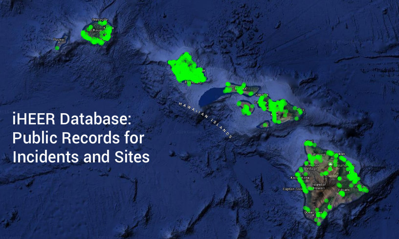
Go to iHEER
iHEER Information and Limitations
On July 1, 2015, the HEER Office began using a new online system for public records called iHEER but still has not fully switched over to the new system so it has limitations.
INCIDENTS in iHEER
Incidents are hazardous substance releases overseen by State On-Scene Coordinators in the EP&R Section.
- Information on Incidents occurring on or after July 1, 2015 is entered directly into iHEER.
- Closed Incidents occurring on or after July 1, 2015 are listed in the iHEER Incidents module for the public to look at online. Ongoing Incidents from the same period will not be listed in the public view, therefore the Incident module will not show all of the Incidents that HEER has received.
- Closed Incidents occurring on or after July 1, 2015 that have been assigned a latitude/longitude are displayed in the online map Viewer. Some Incidents have not been assigned a latitude/longitude, therefore the map Viewer will not yet show all of the listed Incidents.
- Incident Documents are available for closed Incidents occurring on or after July 1, 2015.
- Incidents occurring before July 1, 2015 are not yet in iHEER
- If you need to get Documents for an Incident occurring before July 1, 2015, please continue to fill out a Public Record Request and submit it to HEER.
SITES in iHEER
Sites are contaminated or potentially contaminated areas overseen by State Remedial Project Managers in the SDAR Section.
- In September 2019, HEER Office’s information on Sites was added to iHEER. Although all Sites are now in iHEER, some sites are not included in the public listing for various reasons, such as protected documented information. You may still make a Public Record Request for the non public sites listed in Instructions for Use.
- Sites that have been assigned a latitude/longitude are displayed in the online map Viewer. We are adding site location information daily to iHEER but some sites have not yet been assigned a latitude/longitude, therefore the map Viewer will not yet show all of the listed Sites.
- Be aware that site location information may not be exact and boundaries are hand drawn and approximate.
- Site Document data transfer is ongoing and not all documents are currently available via iHEER. If you need to get the complete record for a Site, please continue to fill out a Public Record Request and submit it to HEER. You will then be notified when the Site document listing is complete and available to download via iHEER. See Instructions for Use below for selected iHEER data in tabular format.
A Locations Type dropdown has been added to the Viewer. Location Types include: Site Centroid, Site Boundary, Site Feature (point, line and polygon), Management Area, and the Controls: CEHMP, EHMP/IC/LUC, AEHMP and NFAIC. A Control filter is also available. The Viewer default displays Site Centroids only.
| Keywords to aid in searching for specific groups of Sites have been added as aliases. | |
| Group | Alias |
| Brownfields | The word Brownfields with a phrase indicating why the site is considered Brownfields (e.g., Brownfields Funded) |
| Sea Level Rise Exposure Area | SLR 3.2ft Flooding |
| Area defined by modeling the 1% annual-chance-coastal flood event with 3.2 feet of sea level rise |
1% flood risk with SLR 3.2ft |
| Vapor Barriers Installed | Vapor Barrier |
| Construction | Construction EHMP |
| Sites that may be investigated for PFAS | Potential PFAS |
HEPCRA in iHEER
HEPCRA records include Tier II forms submitted by covered facilities.
- HEPCRA facility information is available in iHEER. To request documents for a HEPCRA facility, please continue to fill out a Public Record Request and submit it to HEER.
INSTRUCTIONS FOR USE
1. We are currently updating our site information. You are welcome to browse our Viewer and Search our Sites and Incidents lists for contaminated sites, but be aware that:
- Some sites, for various reasons, such as protected documented information, have not been included in the public iHEER listing.
- Site information may not be exact.
- Not all sites will be displayed on the viewer map.
- Boundaries are hand drawn and approximate.
Selected iHEER Data in List and Map Formats
In iHEER, the Viewer-Sites Tab, has a filter for Controls=Yes/No (that’s based on the RPM creating a Location of the type Control). There’s also a Location Type dropdown at the top right of the Viewer map. Additionally, use the Advanced Search in the Site List to find Site Status values that indicate there’s a hazard and/or that controls are needed, selected or in place. (The term “Potential Hazards and Controls”, used when summarizing data from an older MS Access system, is no longer in use.)
Location type possible values are: Site Centroid, Site Boundary, Management Area, Site Feature (Point), Site Feature (Polygon), Site Feature (Line), CEHMP, AEHMP, EHMP/IC/LUC and NFAIC.
-Location types of Site Centroid, Site Boundary, Management Area, Site Feature (Point), Site Feature (Polygon), Site Feature (Line) may or may not require controls.
-Location types of CEHMP, AEHMP, EHMP/IC/LUC and NFAIC indicate a control.
Site Status possible values are: Unreviewed, Site Discovery, Assessment, Remedy Needed, Remedy Selected, Remedy In Place, NFAIC, NFA – Unconfirmed, ISST NFA – No Letter, NFA – Type Undetermined, NFA, Consultation, Referred.
-A Status of Unreviewed, Site Discovery, Assessment, NFA – Unconfirmed, ISST NFA – No Letter, or NFA – Type Undetermined, Consultation, Referred may or may not require controls.
-A Status of Remedy Needed, Remedy Selected, Remedy In Place, NFAIC indicate a control.
The Location type and Status may not agree, so look at both.
2. You can find Sites and Incidents, and their associated Documents online in the iHEER database via lists or the Viewer(s). No login is required for this. There are different lists:
- Sites: non-emergency assessment and remediation sites
- overseen by HEER’s Site Discovery, Assessment, & Remediation (SDAR) Section
- Some SDAR Sites or Documents may also not be listed for various reasons (e.g., proprietary business information, ongoing litigation, potential security threats, protected personal information, Navy sites, Brownfield sites).
- Incidents: emergency responses and initial release notifications
- overseen by HEER’s Emergency Preparedness & Response (EP&R) Section
- Note that online Incidents are only listed, if they are 1) closed and 2) younger than July 2015. If you wish to see the documents for incidents prior to July 2015, you need to fill out a record request form and send it to us.
3. For searches in the Sites or Incidents lists, we recommend you use the Advanced search button (top right of the page)
- do not use the search bars in the columns, because your search will be limited to 500-1000 entries that can be displayed at one time. You can search by key words or different categories.
4. For searches in Viewer
- you can search/filter incidents by address or name in the Keywords search bar on the blue tabs if your incident is in the database.
- you can search/filter sites by address or name in the Keywords search bar on the blue tabs if your site is in the database. Sites without a location will be included.
- you can search/filter sites by the presence of Controls Controls search bar on the blue tab if your site is in the database.
- You can also zoom to addresses that are not in the database. If you want to screen for Sites/Incidents in the vicinity of a specific area or target site that is not in the database, use the Search Bar on the top right of the Viewer tool. Type your address so that a valid match appears below the search bar (in blue, with white bars at the top and bottom), select the valid address, click the magnifying glass, and the Viewer will zoom to the address. Surrounding Sites or Incidents will be visible. Make sure to clear the Keywords search bar in the blue Viewer pane first to avoid filtering away Sites/Incidents in the vicinity of the address of interest.
5. Site document data upload is ongoing and not all documents are currently available via this website. If you need to get the complete record for the site, please fill out a record request form and submit it to us, but please read and follow our guidelines under Record Request and submit as much identifying information about the site (e.g., name, TMK, address, Site ID) as is displayed in iHEER. Since we receive many record requests daily, this will help us find the documents quickly and efficiently. You will be notified when you will be able to download all information via iHEER.
RECOMMENDATIONS AND NOTES
a) Be patient! Once you’ve landed on a Viewer page, count slowly to 10. For searches in Search Bars, type slowly or hit the reload button after typing in your search. This will improve the filtering. Site/Incident markers will slowly appear as the data is loaded. Once loaded, the Viewer zooms out. Once zoomed out, you can either type something into the Search Bar on the blue tab or you can zoom into a specific island with the “Zoom To” button at the top right of the page. Markers or colored areas are clickable. You can further zoom into the area of interest by using your computer mouse wheel or the “+” button on the top right of the page. If you type the search, or use the “Zoom To” button, too early (when the viewer is still loading) the viewer zooms out again, which can be a frustrating experience. Information on any site can then be accessed via the “Details” button on the viewer tab. Once on the Details page of the Site/Incident, you can access and download available documents on the Documents tab at the left side of the page.
b) Enter tax map key (TMK) numbers in the format DZSPPPppp (D=district, Z=zone, S=section, P=plat, p=parcel). Omit non-numeric characters; use leading zeroes in plat and parcel numbers; and include the district number (City & County of Honolulu=1, Maui County=2, Hawaiʻi County=3, Kauaʻi County=4).
c) You can switch easily between Sites and Incidents on the Viewer by clicking on the different tabs in the blue area of the Viewer Panel. Green markers indicate SDAR Site locations, and orange/blue markers indicate Incident locations.
d) iHEER is still work in progress and will be expanded upon in the future. Some entries are not updated yet. For Sites, the categories “Priority” and “Status” are not updated. The default for “Priority” is “Unranked” and for Status it is “Unreviewed”. Do not rely on the entries in these categories. The category “Assigned RPM” shows the current Remedial Project Manager assigned to a site. Only current RPMs are listed. Previous RPMs are included in “Unassigned”. We are currently in the process of updating Document types, but they may not all be identified yet.
e) Some documents may be split up into different files due to file size or transfer from a combined folder from our old database system. This will be apparent either in the Document “Title” column or in the “Imported From” column that displays a common file path.