Environmental Geographic Information System
The Environmental Planning Office (EPO) closed effective May 2, 2018. Due to federal EPA funding reductions, the office is no longer providing services. The information posted here will temporarily remain in place for public reference. For Standard Comments, please see the EPO Land Use Planning Review webpage or contact the appropriate Environmental Health Administration branches and offices directly using DOHEHALandUseContactList_20250917.pdf.
~~~~~~~~~~~~
The Environmental Geographic Information System (EGIS) provides GIS services and support to a wide range of DOH programs and the public. By linking spatial and database information, EGIS enables the visualization and analysis of environmental patterns, relationships, and trends. This dynamic system provides vital information and fresh perspectives on environmental issues.
Currently, EGIS is working on gathering new datasets to provide additional, high-quality informational maps for the people of Hawaii.
MAP SERVICES
Click on the following Map Services to learn more.
Environmental Planning Office (EPO)
Environmental Health Management Web App. Click on the map above.
Environmental Health Management Atlas
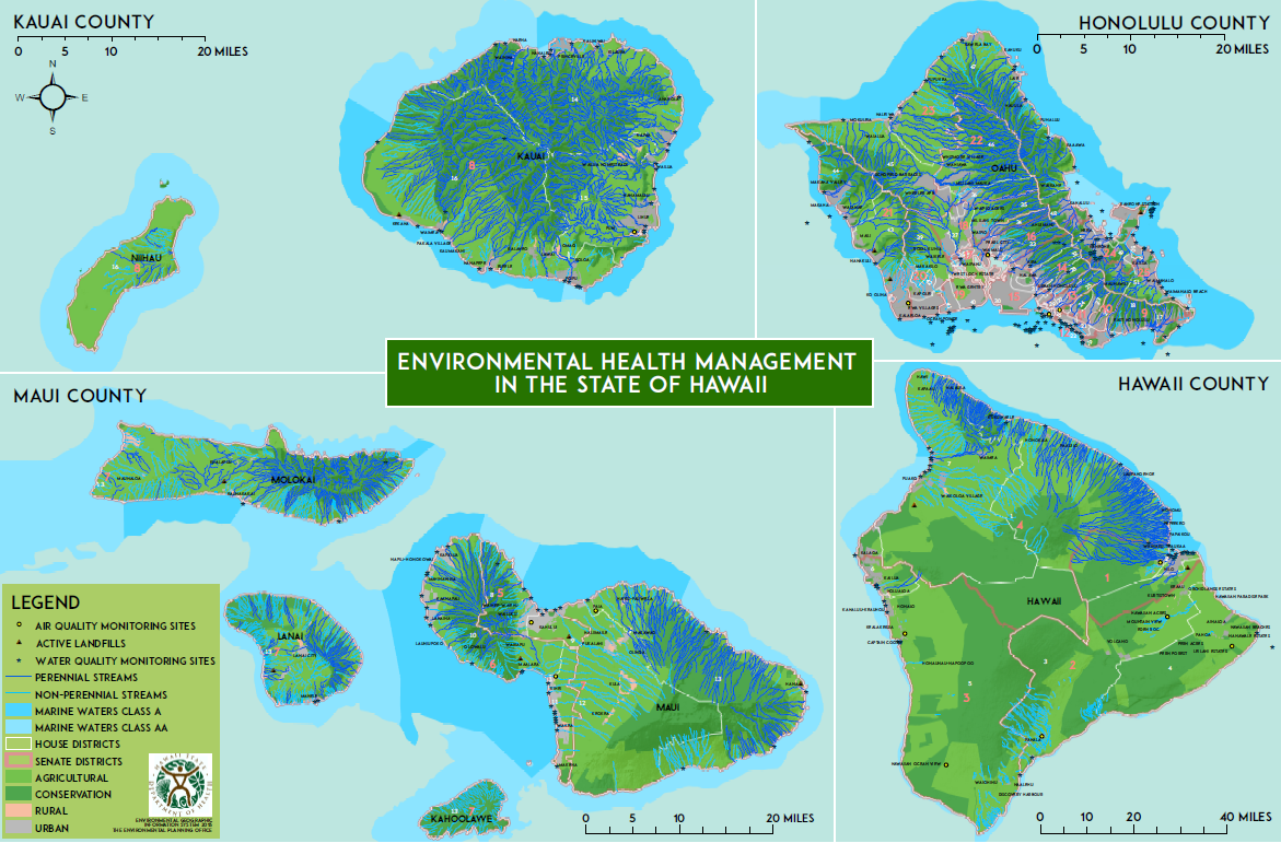
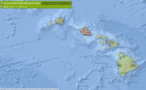
Environmental Health Management in the State of Hawaii
An Environmental Management Atlas of Hawaii (22″ x 17″ documents”) is now available.
Click on the links below to open as .pdfs.
Environmental Health Management Atlas Maps (2015):
State of Hawaii (Low Res.)
Hawaii Island
Maui Island
Molokai, Lanai & Kahoolawe
Oahu
Kauai & Niihau
Environmental Health Warehouse (EHW)
DOH-Environmental Information Management (EIM) oversees the Environmental Health Warehouse, a map viewer containing relevant permit information for EPO land use review:
ENVIRONMENTAL MANAGEMENT DIVISION (EMD):
Click on the following EMD branches to learn more.
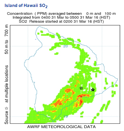
Clear Air Branch (CAB)
Air Now: Hawaii (External)

Hawaii Clean Air Branch: Air Monitoring Maps
Hawaii Island: State Greenhouse Gas (GHG) Rule Affected Facilities
Maui Island: State Greenhouse Gas (GHG) Rule Affected Facilities
Molokai Island: State Greenhouse Gas (GHG) Rule Affected Facilities
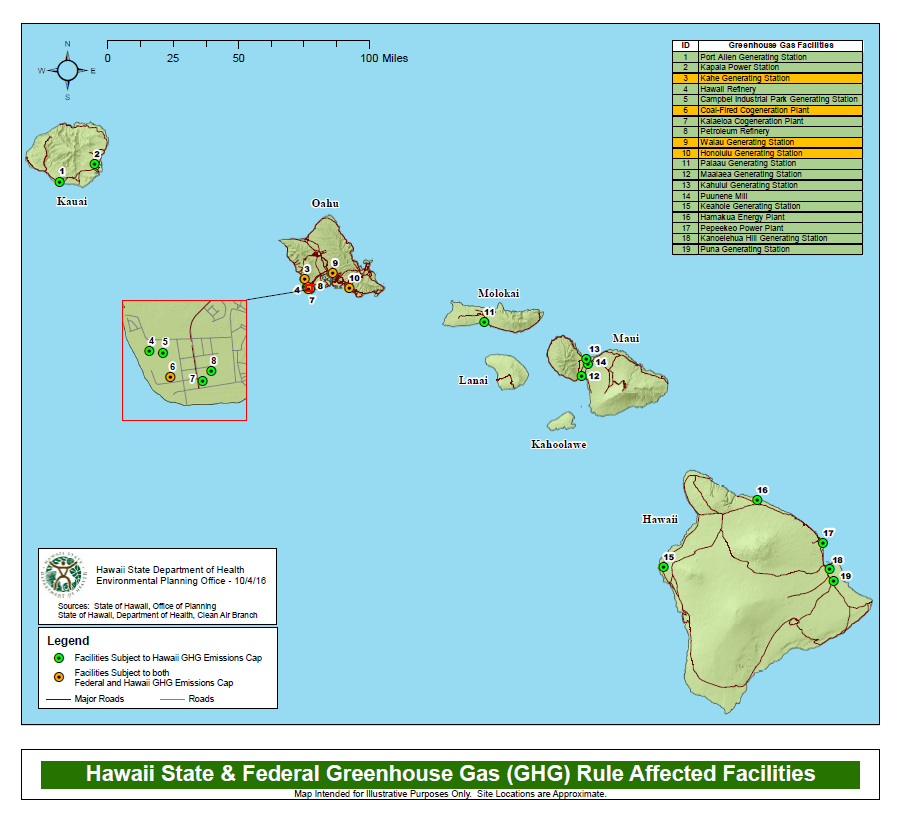
Oahu Island: State & Federal Greenhouse Gas (GHG) Rule Affected Facilities
Kauai Island: State Greenhouse Gas (GHG) Affected Facilities
Hawaii Island: DOH Regulated Point Source Emitters
Maui Island: DOH Regulated Point Source Emitters
Hawaii Island Regional Haze Visibility Monitoring Map
Maui Regional Haze Visibility Monitoring Map
EPA 2011 National Air Toxics Assessment (NATA) App
Clean Water Branch (CWB)
Water Monitoring Locations Web Map
Perennial and Non-Perennial Streams — See EHM maps (above)
Safe Drinking Water Branch (SDWB)
Groundwater
The Groundwater Contamination Viewer uses monitoring data for public drinking water wells, select non-potable wells, fresh water springs, and other testing data available to the DOH. The system identifies organic and other chemical contaminants that have been detected and confirmed in drinking water wells, select non-potable wells, and fresh water springs throughout Hawaii.
https://eha-web.doh.hawaii.gov/gw-contam/

Underground Injection Control (UIC)
Underground Injection Wells are wells used for injecting water or other fluids into a groundwater aquifer. Department of Health Administrative Rules, Title 11, Chapter 23 provides conditions governing the location, construction, and operation of injection wells so that injected fluids do not migrate and pollute underground sources of drinking water. Section 4 of the Rules gives the criteria for classifying aquifers into those that are designated as underground sources of drinking water and those that are not.
The boundary between non-drinking water aquifers and underground sources of drinking water is generally referred to as the “UIC Line”. Restrictions on injection wells differ, depending on whether the area is inland (mauka) or seaward (makai) of the UIC line.
The UIC Maps show the areas inland and seaward of the UIC line on all major islands. These maps are meant for general informational purposes only. The Department holds the official UIC maps containing detailed information about the UIC Line. For more information, contact the Safe Drinking Water Branch’s UIC Program.
Click here for: UIC Maps of Hawaiian Islands
Wastewater Branch (WWB)
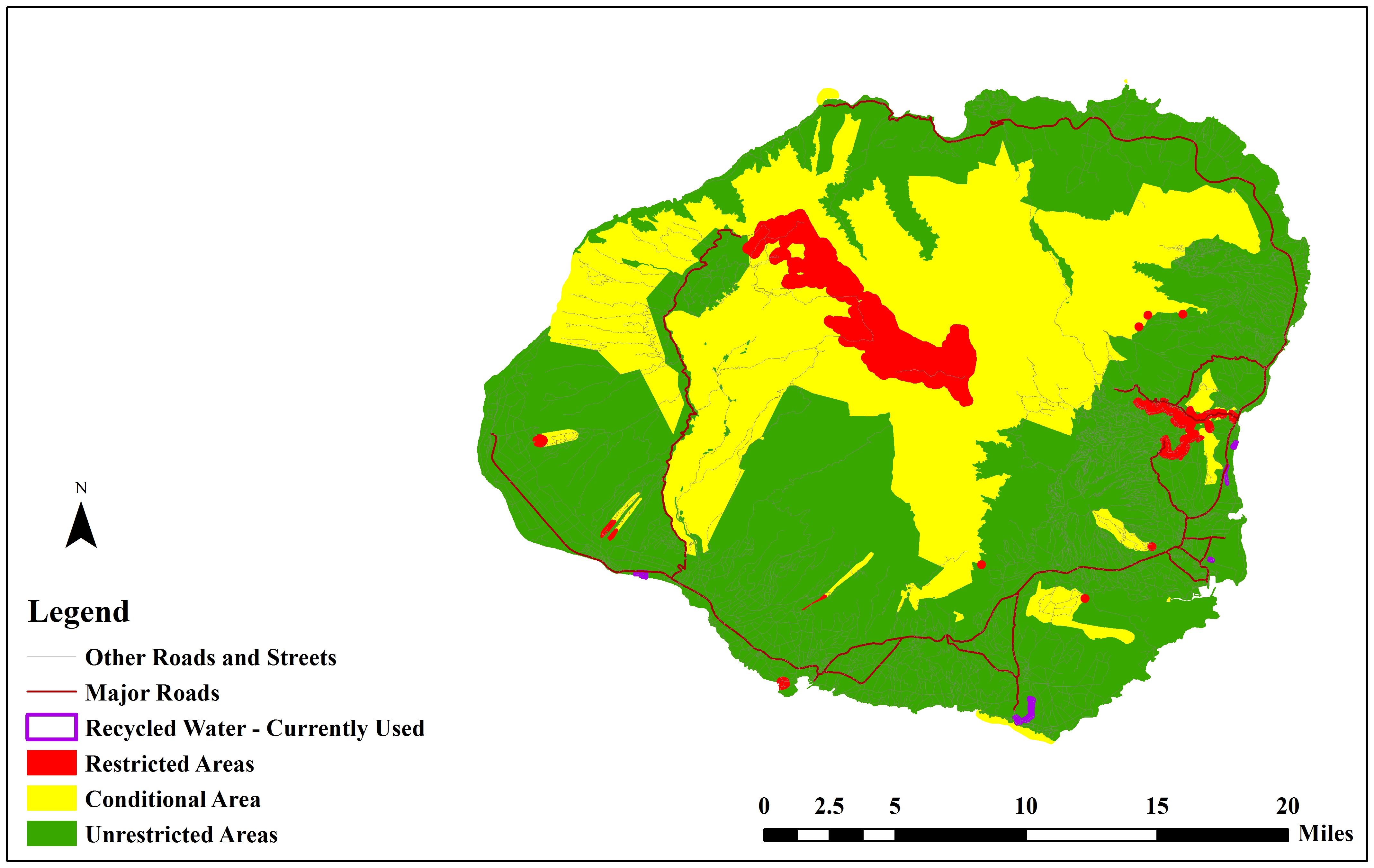
Recycled Water
Recycled water use maps designate areas where the use of recycled water is restricted, conditional, or unrestricted. Although most areas allow for unrestricted recycled water use, certain sensitive areas that may be potentially impacted by recycled water use are subject to notification and monitoring requirements.
The Recycled Water Use GIS Web App allows users to search by TMK or address to determine their recycled water use classification. Click here: 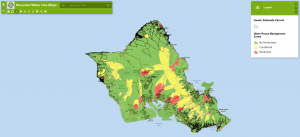
Reuse Guidelines (revised in January 2016) on recycled water are now posted at the following site, along with application forms, report forms, and a summary presentation of the revisions:
https://health.hawaii.gov/wastewater/home/reuse/
Click below for static maps of recycled water reuse classifications by island:
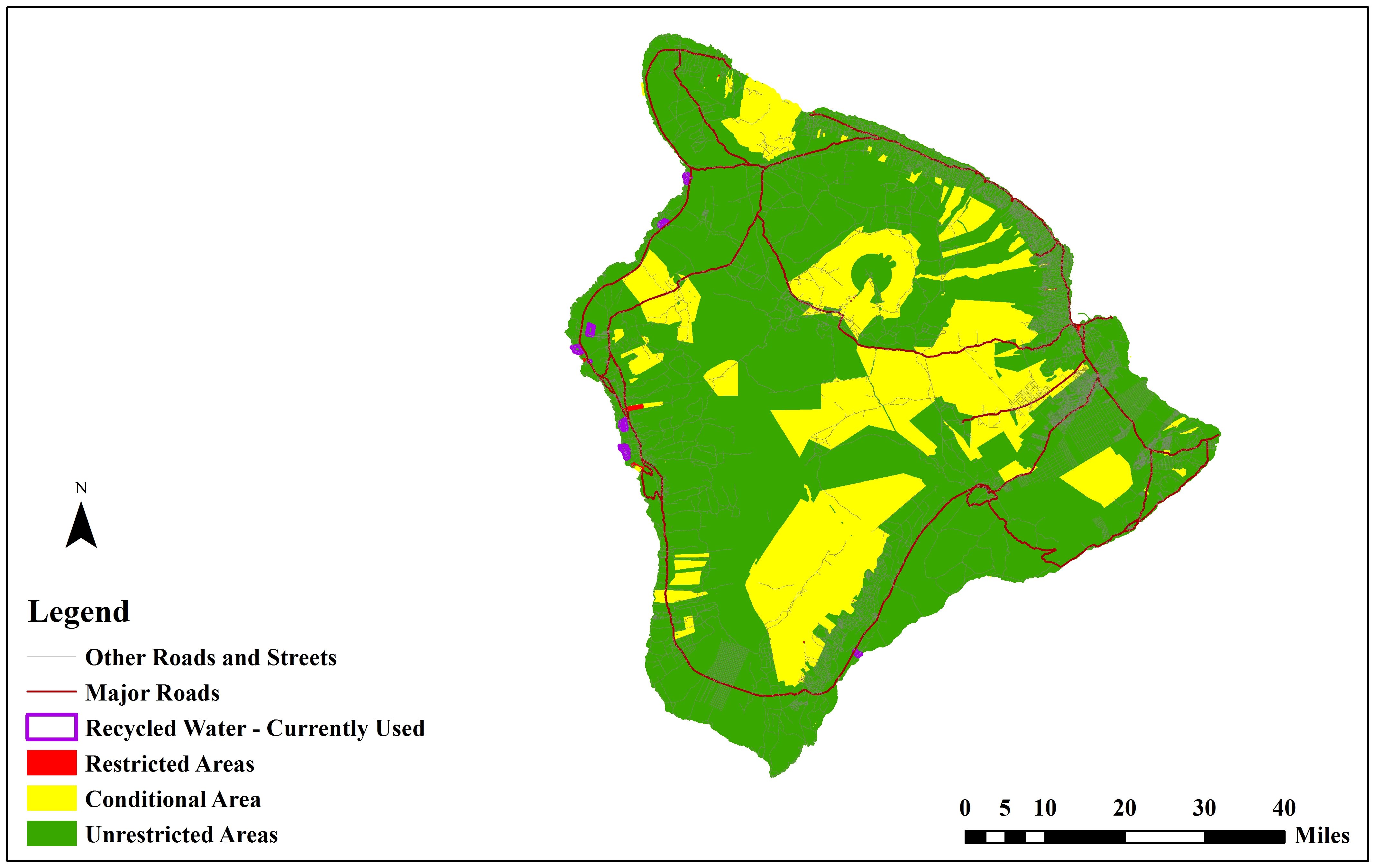
Recycled Water Reuse Map Hawaii
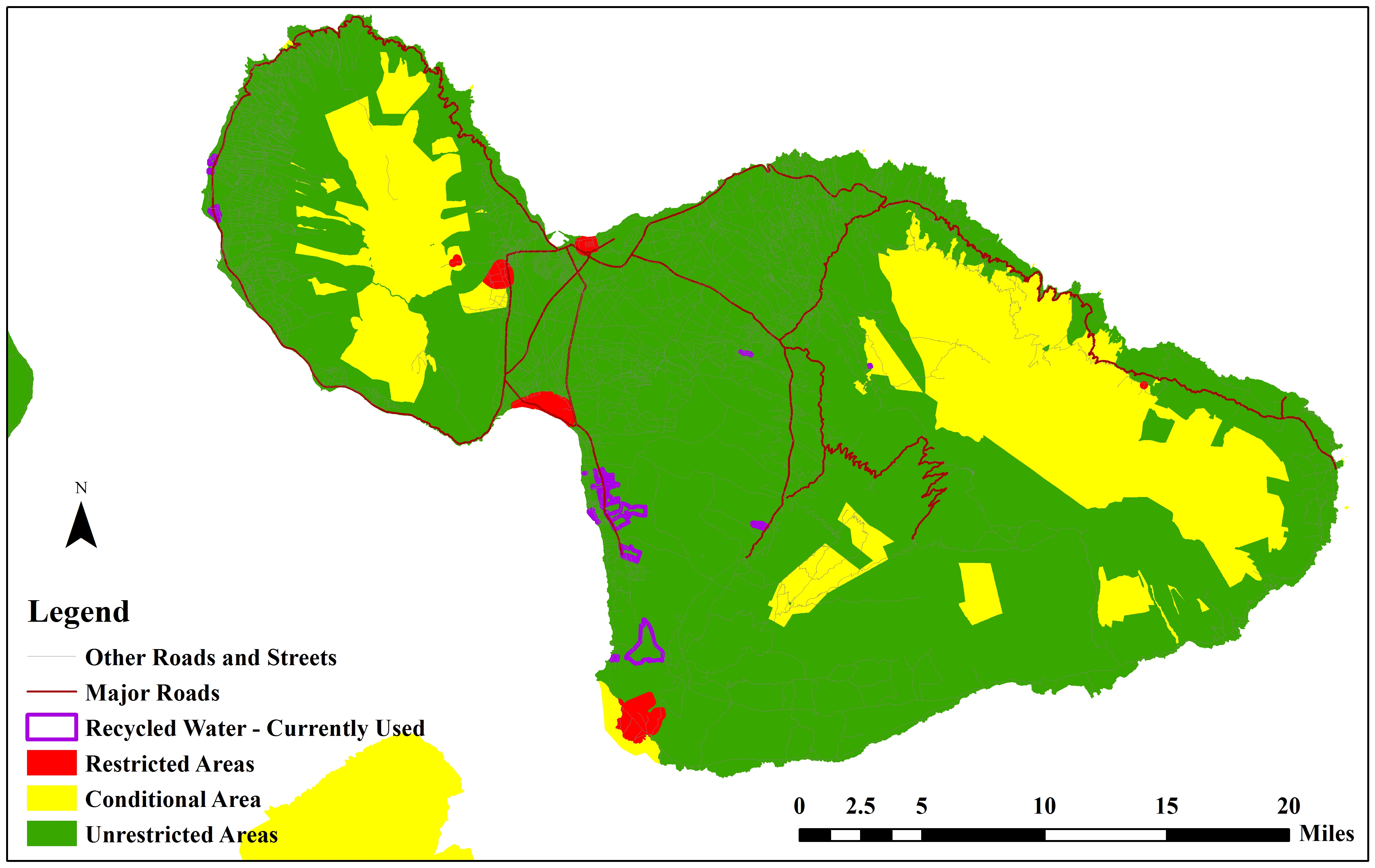
Recycled Water Reuse Map Maui
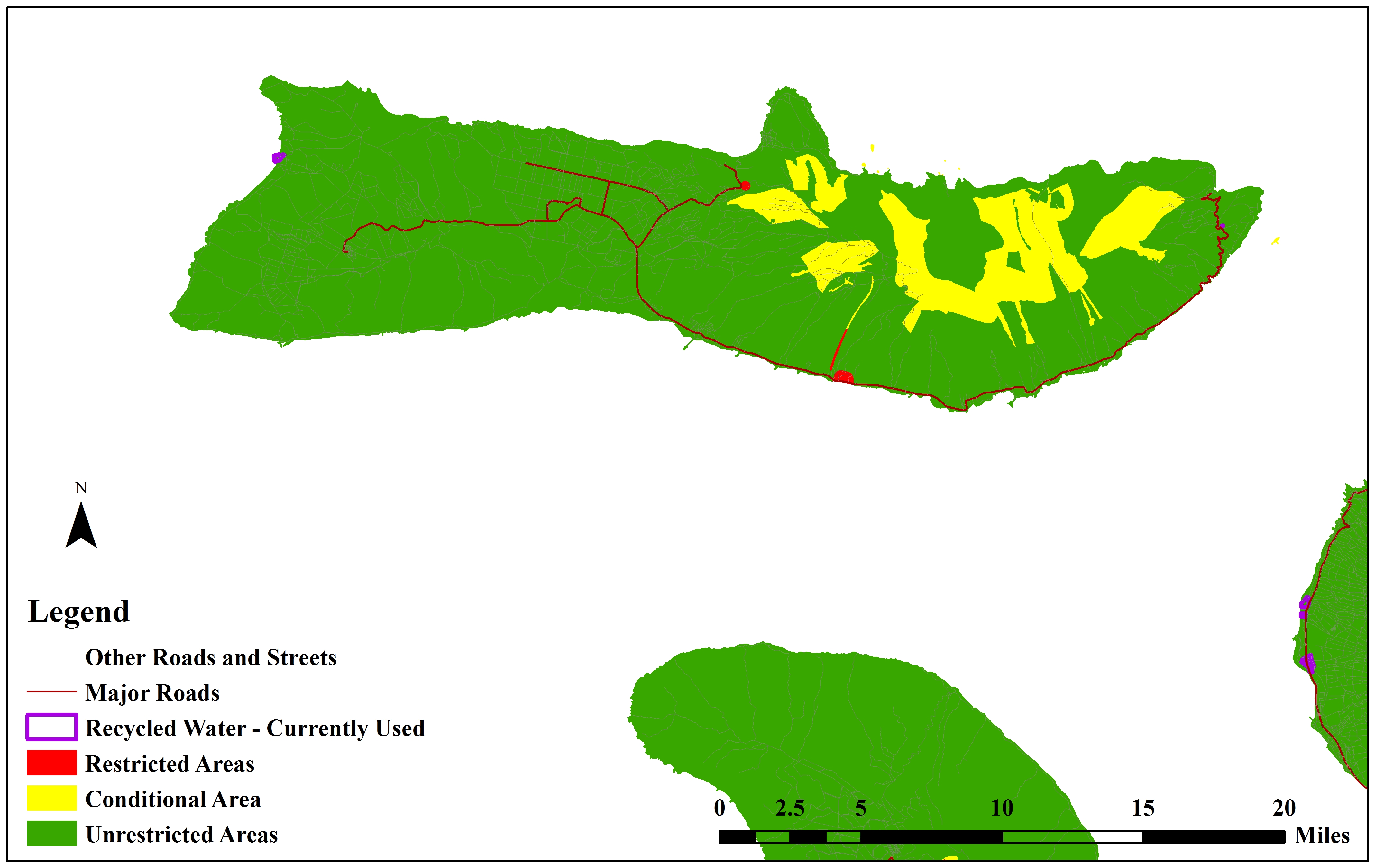
Recycled Water Reuse Map Molokai

Recycled Water Reuse Map Lanai
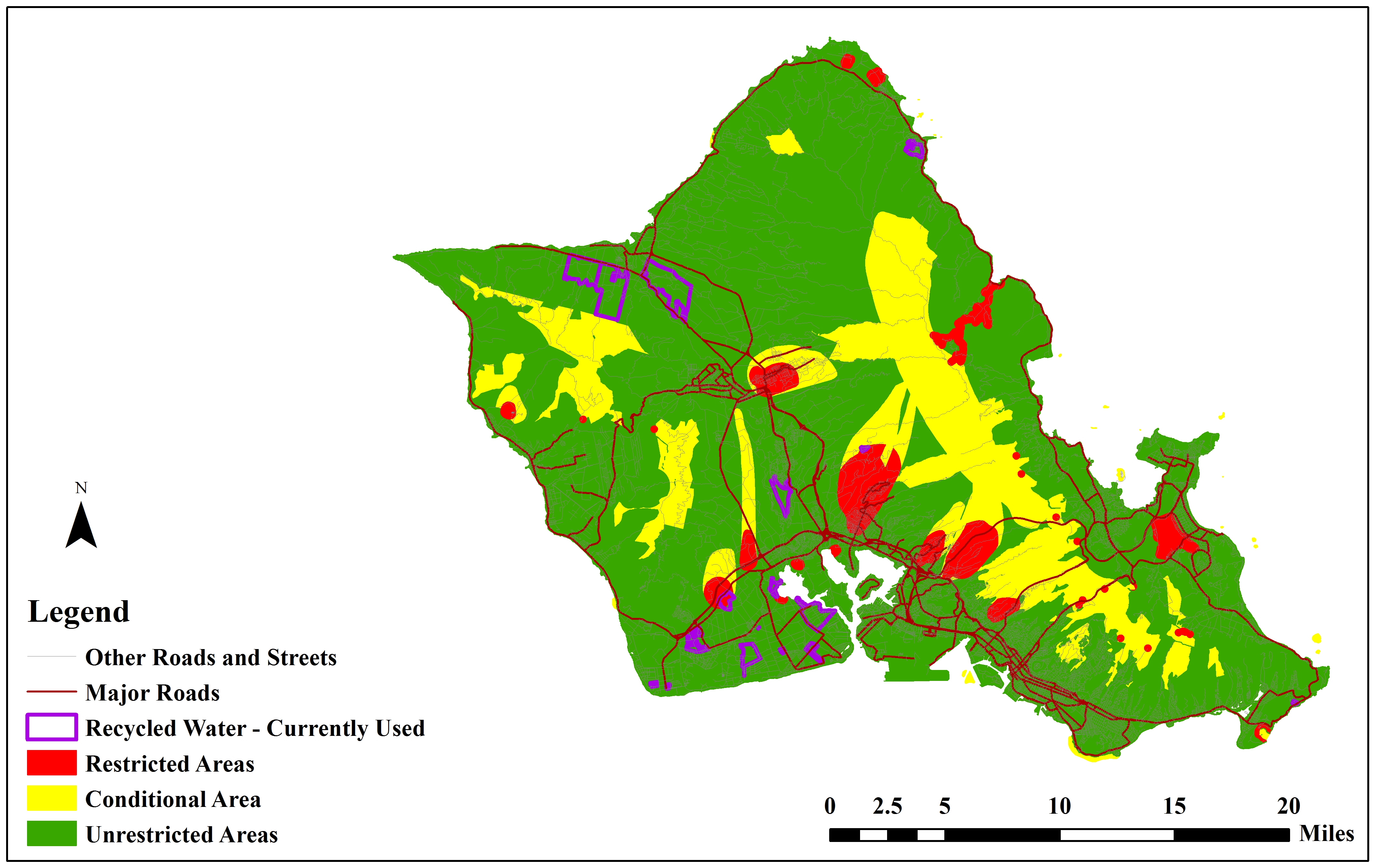
Recycled Water Reuse Map Oahu
Recycled Water Reuse Map Kauai
Cesspools
GIS Web Application search for Qualified Cesspools based on TMKs: GIS Web App Search Viewer
Click here https://health.hawaii.gov/wastewater/home/taxcredit/ for more information.
Solid & Hazardous Waste Branch (SHWB)
Recycling Centers
The Deposit Beverage Container Program has a new search tool to now make it easier for Hawaii residents to find the nearest certified redemption center(s), including street addresses and current hours of operation:
Find a Redemption Center! (BETA)
Landfills
Data will be provided by the SHWB soon.
Underground Storage Tanks (UST)
Data will be provided by the SHWB soon.
ENVIRONMENTAL HEALTH SERVICES DIVISION (EHSD):
EHSD inspects businesses including food establishments.
SANITATION / FOOD & DRUG:
Hawaii Inspection Health Portal
Use this portal to search and view food inspections performed by the Public Health Department in your area.
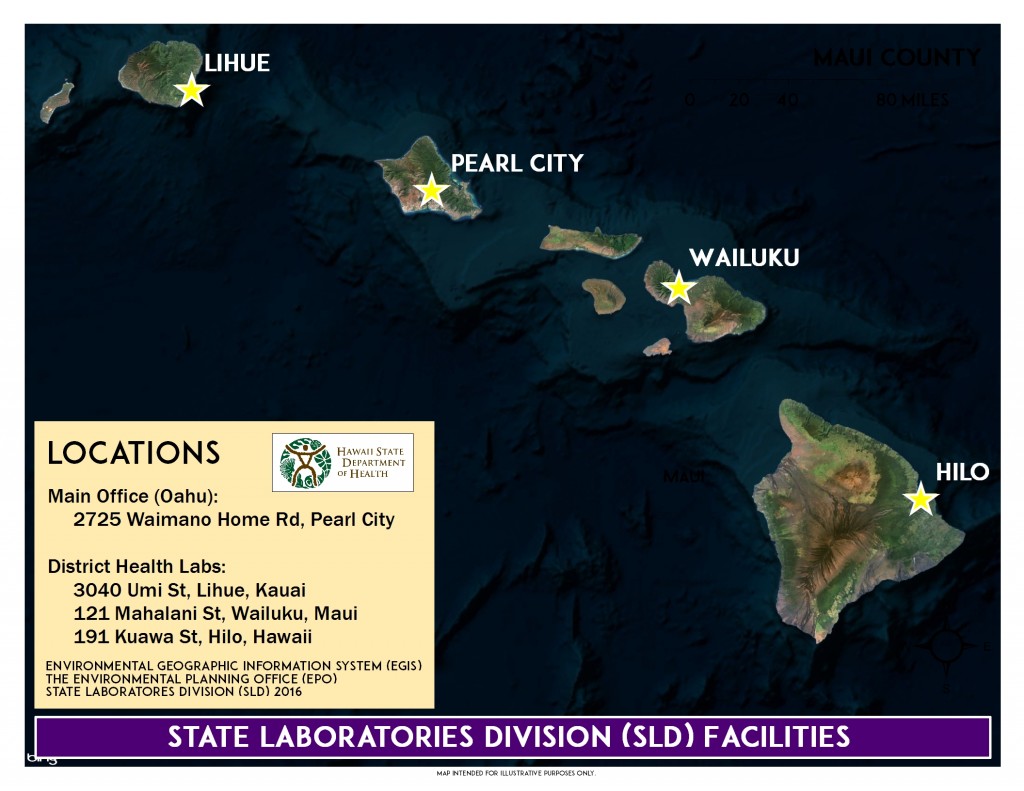
STATE LABORATORIES DIVISION (SLD):
Click below to learn more.
SLD Locations
Other Environmental Health Administration (EHA)
These offices are attached directly to the Deputy Director.
Hazard Evaluation & Emergency Response (HEER) Office
More Information
Learn more about hazardous pollutants at the Hazard Evaluation and Emergency Response (HEER) Office.
- HEER Home Page
- Soil Arsenic Guidance and Information
- Summary of Pesticide and Dioxin Contamination Associated with Former Sugarcane Operations
Island of Hawaii Lava Flow Hazard Zones
USGS
https://hvo.wr.usgs.gov/hazards/lavazones
https://hvo.wr.usgs.gov/maps
County of Hawaii – Civil Defense Lava Flow Maps
https://www.hawaiicounty.gov/lava-related-maps
U.S. National Parks
https://www.nps.gov/havo/planyourvisit/maps
Cleanup Sites (EPA Web Viewer)
Pesticide Mixing Areas
Data will be provided by HEER soon.
Other
EGIS also coordinates with relevant state and federal partners.
Related Services
Although our primary focus has been to provide support to environmental health programs within the Department, EGIS personnel also work with other DOH programs.
For more information please refer to the Hawaii Statewide GIS Program.
US EPA
Environmental Justice: EJSCREEN
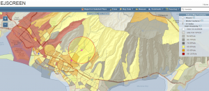 The US Environmental Protection Agency (EPA) has developed its own environmental justice GIS:
In order to better meet the Agency’s responsibilities related to the protection of public health and the environment, EPA has developed a new environmental justice (EJ) mapping and screening tool called EJSCREEN. It is based on nationally consistent data and an approach that combines environmental and demographic indicators in maps and reports.
Water Viewer
This robust, online mapping tool provides the public, water system operators, state programs, and federal agencies with critical information to help them safeguard the source of America’s drinking water:
https://www.epa.gov/sourcewaterprotection/dwmaps
EPA CAMEO (Computer-Aided Management of Emergency Operations) is a system of software applications used to plan for and respond to chemical emergencies. Developed by EPA and the National Oceanic and Atmospheric Administration to assist front-line chemical emergency planners and responders, CAMEO can access, store, and evaluate information critical for developing emergency plans.
US Army Corps of Engineers
Other Hawaii GIS Tools
Hawaii Conservation Alliance Communication & Implementation Tools:
Honolulu Land Information System (HoLIS): Interactive Map Selector
The City and County of Honolulu has developed one of the most comprehensive GIS data base for any municipality of its size. The Honolulu Land Information System (HoLIS) is an enterprise-wide system serving over 15 City Departments with land use, permit, tax, infrastructure, and environmental data. Geographically referenced information links existing City records to precise locations on the island of Oahu for spatial query and analysis.
Last update: 09/17/2025 (first paragraph only)
