Using GIS to discover historic areas of contamination
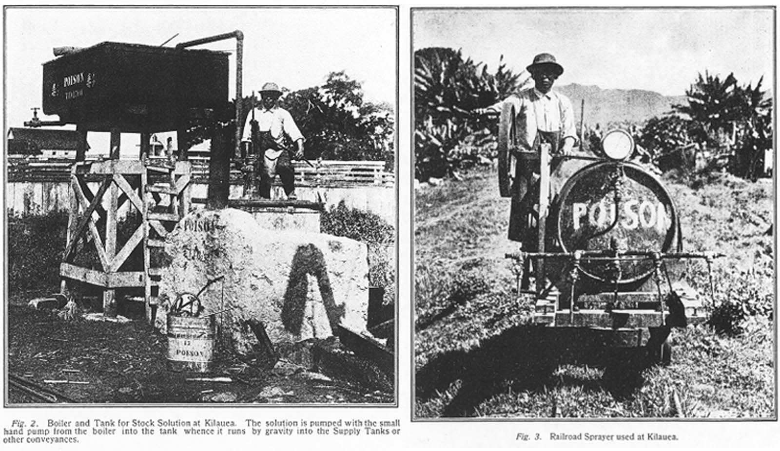
The Department’s Hazard Evaluation and Emergency Response (HEER) Office has been investigating soil contamination from historic sugar plantation sites in Hawaii for a number of years. When a HEER staff member came across photos taken in 1914 showing a plantation worker standing amidst containers marked “poison” at Kilauea, Kauai, efforts began to investigate the site.
The Kilauea Sugar Company had operated at this location from 1877 to 1971. After the plantation closed, the land was put up for sale and later developed into a residential community. The HEER Office obtained old fire insurance maps of the site showing buildings that were formerly used for pesticide mixing and storage. Although these buildings had since been torn down, they were surprised to find that several other original warehouse buildings in the area were still standing.
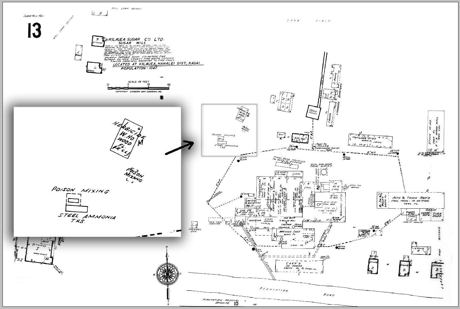
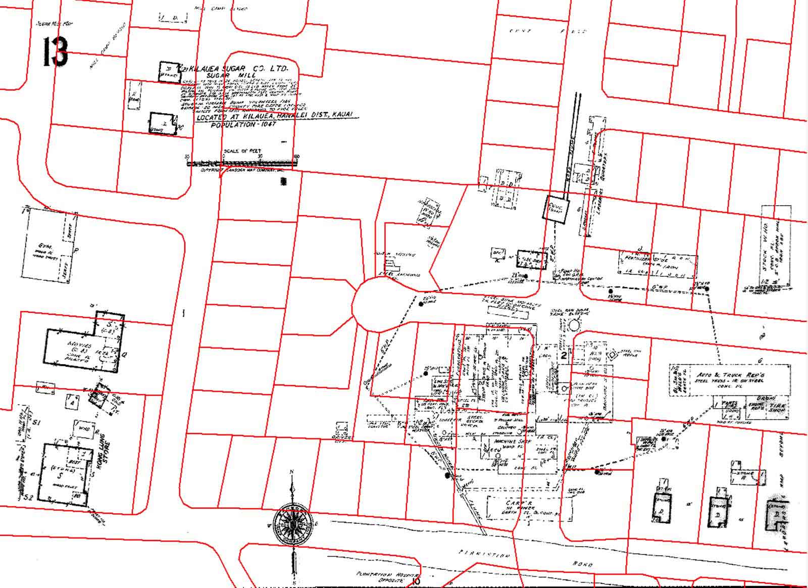
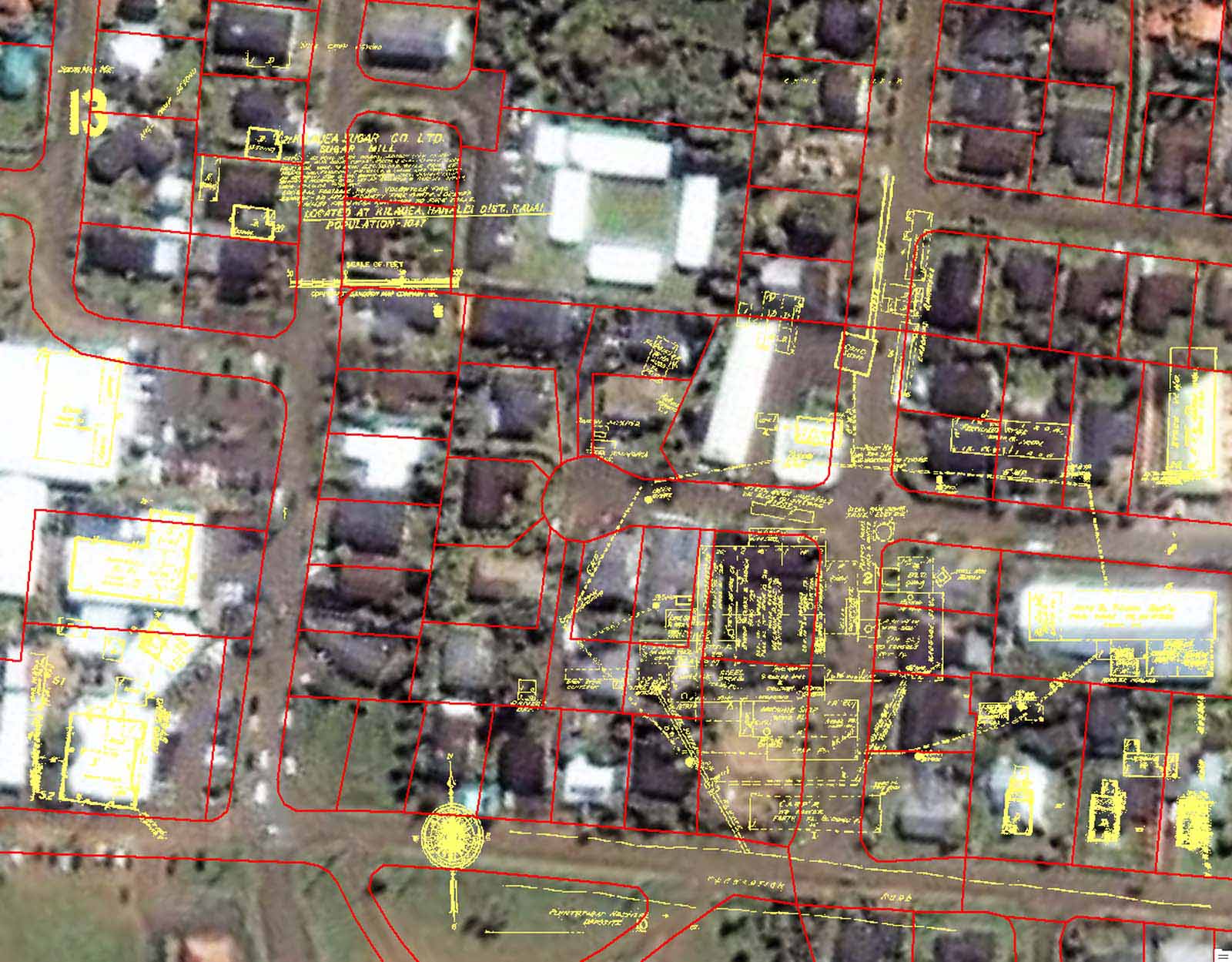
The scanned maps were overlaid onto an aerial image of the area and georeferenced using the warehouses for reference points. Since the map image was now properly spatially located, it could be placed on a parcel layer showing property boundaries. This allowed them to identify the affected property owners and addresses in the area.
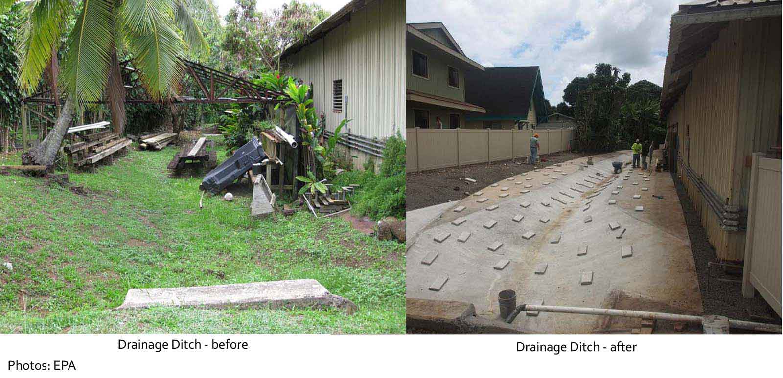
HEER staff contacted property owners and conducted soil testing in the vicinity of the former pesticide mixing/storage facility. Soil samples showed high levels of arsenic and moderate levels of dioxin residues. These levels exceeded State and Federal Environmental Action Levels (EALs) at two residential properties and in a stormwater drainage ditch behind a commercial warehouse.
An extensive cleanup program began, resulting in the removal of 814 tons of contaminated soil in the area. Sampling of other properties in the community showed that the surface and subsurface soils did not pose a health risk. The contaminated soils were removed and replaced with new clean soil. The drainage ditch was capped with a concrete barrier to provide stormwater drainage while continuing to isolate any additional contaminated soils.
230 air samples were taken throughout the process and showed no detection of any contaminants being released by the work.
This project was a cooperative effort between the U.S. Environmental Protection Agency, the Hawaii Department of Health, the Kilauea Community, and the County of Kauai. Cleanup activities were completed on September 17, 2012. The HEER Office will oversee implementation of Environmental Hazard Management Plans to ensure that the remedies provide long-term protection to the affected properties.
A story detailing the discovery of the Kilauea site and its resolution was recently published in the Hawaii Journal of Public Health. It can be found here.
Environmental Planning Office
919 Ala Moana Blvd., Room 312
Honolulu, HI 96814
phone (808) 586-4337
Last update: 10/16/2015