
Coastal Waters
Air | Ash and Debris | Beach Sand | Coastal Sediment | Coastal Waters | County Parks | West Maui TDS Site | Soil
Maui Wildfire Data: Nearshore Coastal Water Quality
Following the wildfires, ash may have entered coastal waters via wind or surface runoff. This ash can contain substances such as arsenic, heavy metals, and asbestos, which pose risks to human health.
To protect our nearshore environment, the following measures were taken:
- Stormwater Best Management Practices (BMPs) were installed throughout Lahaina to filter runoff.
- Soiltac® was applies to soil and debris surfaces to prevent windblown ash from reaching the ocean.
DOH and partners continue to monitor nearshore waters to address the following:
- To what extent have the wildfires affected coastal water quality?
- Are coastal waters safe for recreational usage by the community (e.g. swimming, fishing) without significant health impacts from the wildfires?
- Are further actions needed to keep settled ash from entering the ocean?
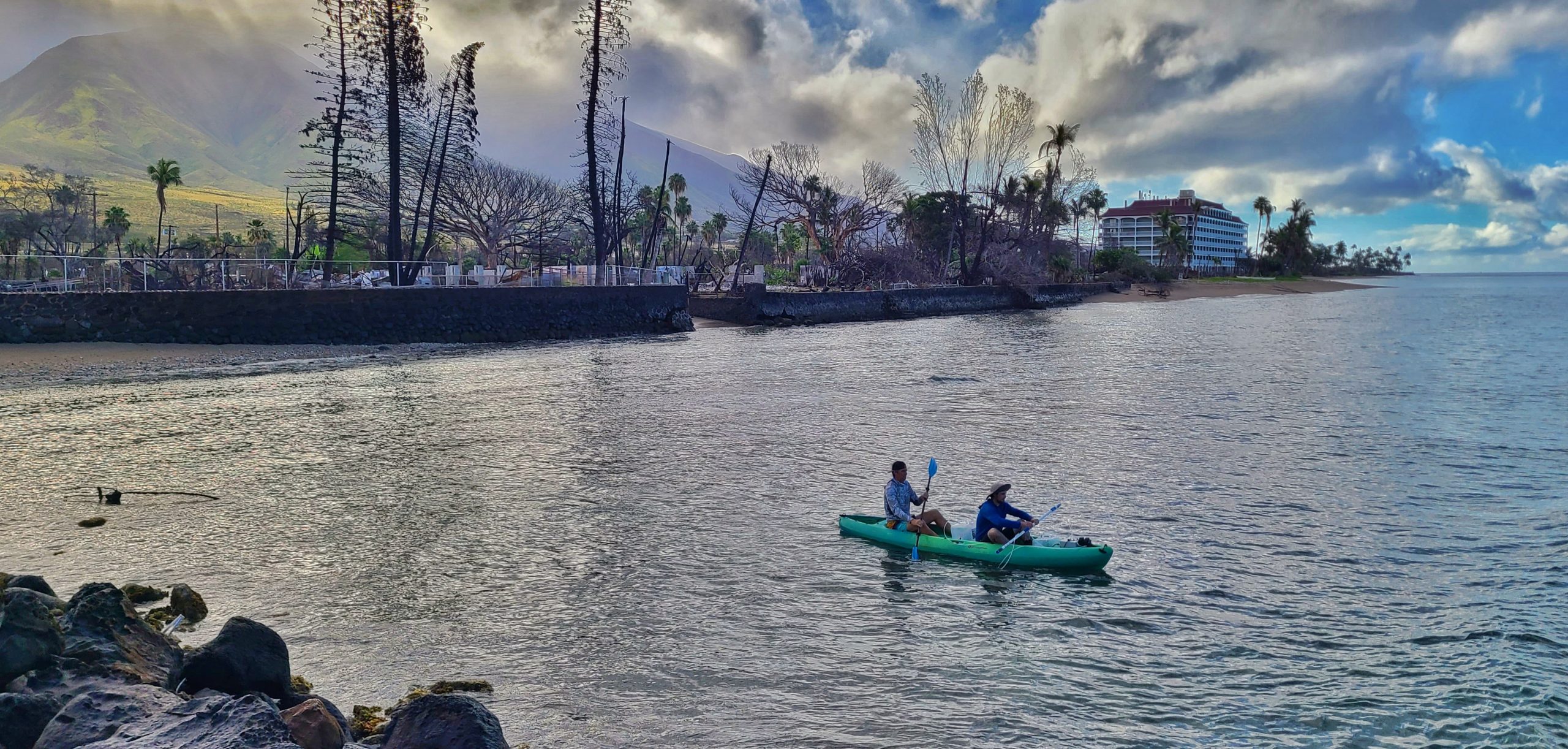
Monitoring to date confirms that the coastal waters around Lahaina are safe for recreation and that concentrations of potentially harmful fire-related substances are well below levels of human health concern. Heavy rains can still carry storm (brown) water to coastal environments. Therefore, people continue to be advised not to enter coastal waters during Brown Water Advisory(ies). “Brown water” can contain harmful bacteria.
Water Quality Monitoring Efforts
DOH is reviewing the following sampling efforts:
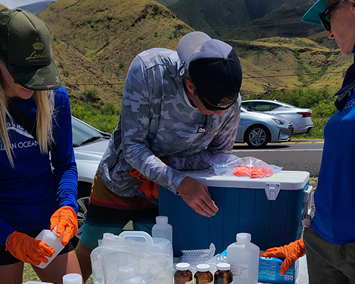
- DOH collects routine water quality indicators every week from nearshore monitoring sites. These indicators include dissolved oxygen, pH, salinity, and turbidity. A summary of recent DOH data is presented on this page. DOH is also collecting nearshore water quality data for metals (total and dissolved), nutrients, and other water quality indicators to further evaluate potential impacts from the wildfires.
- Hui O Ka Wai Ola (HOKWO) has collected water chemistry and nutrient data monthly or bimonthly from 12 sites in the Lahaina area. They will be assisting DOH in collecting upcoming quarterly monitoring for metals and nutrients. Hui O Ka Wai Ola presents a summary of recent data (opens in a new tab).
- The Surfrider Foundation’s Maui Chapter collected grab ocean water samples on January 10, 2024, following a heavy rainfall event and analyzed the samples for metals and polycyclic aromatic hydrocarbons (PAHs). Surfrider also collected samples on June 4, 2024, this time using DOH sample collection guidance to evaluate fire-related metals. Surfrider provides data for these samples (opens in a new tab).
Water Quality Data
DOH Data
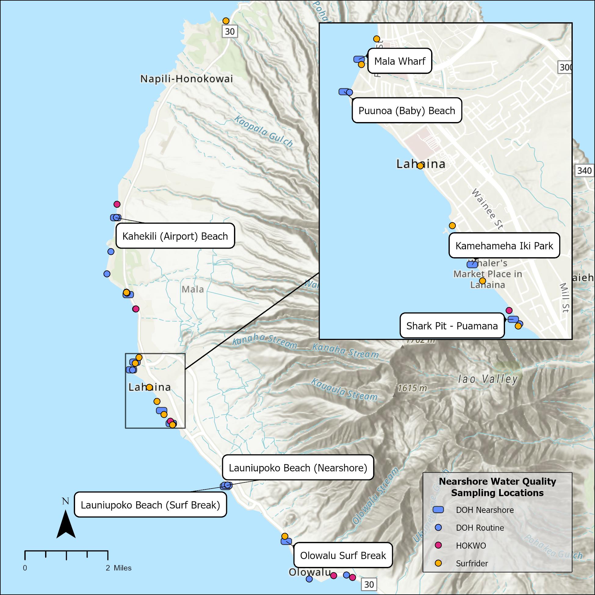
To evaluate impacts from the wildfires, DOH and partners collect nearshore water samples from multiple sites near Lahaina (Figure 1). In 2024, the sampling occurred at seven beaches and two surf breaks, or nine sites in total. Sampling in 2025 and 2026 occurred at six sites, targeting the key areas where changes were observed.
Figures 2 through 5 present summaries of coastal water quality sampling data collected by DOH from the first sampling event in April 2024 through the most recent in February 2026 for total and dissolved metals, nutrients, and conventional water quality parameters. Table 1 shows water quality data from various locations for temperature, salinity, dissolved oxygen, pH, and turbidity, comparing overall water quality data before and after the Lahaina fires.
DOH will continue to collect nearshore water quality samples and will post sampling results to this page.
- The University of Hawaii at Manoa is conducting ongoing research on coastal water quality following the Lahaina fires. The UH results are summarized in a YouTube video (opens in a new tab) from a public presentation on March 11, 2024.
- U.S. Geological Survey (USGS) conducted limited water quality sampling that did not adhere to DOH or U.S. Environmental Protection Agency (EPA) protocols and methods. DOH is currently receiving and reviewing data from these sampling efforts but cannot verify the quality or representativeness of the samples or the analytical data. The data provides context but is preliminary and not suitable for decision-making.
Concentration of Dissolved Fraction Over Time
Non-detects (i.e., values below the method detection limit (MDL)) were substituted with ½ the MDL value.
Figure 2. Interactive time series of dissolved analytes in nearshore water quality samples collected by DOH from April 2024 through February 2026. Water quality standards from HAR 11-54 are displayed for applicable analytes.
Concentration of Total Fraction Over Time
Non-detects (i.e., values below the method detection limit (MDL)) were substituted with ½ the MDL value.
Figure 3. Interactive time series of total analytes in nearshore water quality samples collected by DOH from April 2024 through February 2026.
Concentrations of Conventional Parameters Over Time
Non-detects (i.e., values below the method detection limit (MDL)) were substituted with ½ the MDL value.
Figure 4. Interactive time series of conventional water quality parameters and nutrients in nearshore water quality samples collected by DOH from April 2024 through February 2026. Water quality standards from HAR 11-54 are displayed for applicable analytes.
In-Situ Measurements
Figure 5. Interactive time series of in situ measurements collected during nearshore water quality sampling by DOH from April 2024 through February 2026. Water quality standards from HAR 11-54 are displayed for applicable analytes.
Table 1. Water quality data collected in West Maui before and after the Lahaina fires.
| Pre/Post Fire1 | Location2 | Temperature (°C) | Salinity (ppt) | Dissolved Oxygen (mg/L) | pH | Turbidity (NTU) | ||||||||||||||||||||
|---|---|---|---|---|---|---|---|---|---|---|---|---|---|---|---|---|---|---|---|---|---|---|---|---|---|---|
| Min. | Max. | Avg. | Min. | Max. | Avg. | Min. | Max. | Avg. | Min. | Max. | Avg. | Min. | Max. | Avg. | ||||||||||||
| Pre-Fire | Fire Impacted Sites (Hanaka'o Beach south to Launiupoko Beach Park) | 23.4 | 29.5 | 26.6 | 33.10 | 36.40 | 35.20 | 5.11 | 7.06 | 6.25 | 7.98 | 8.32 | 8.15 | 0.75 | 43.70 | 7.02 | ||||||||||
| Post-Fire | Fire Impacted Sites (Hanaka'o Beach south to Launiupoko Beach Park) | 23.8 | 31.9 | 26.7 | 24.20 | 36.10 | 35.22 | 5.71 | 7.22 | 6.38 | 7.95 | 8.25 | 8.11 | 0.42 | 75.80 | 7.01 | ||||||||||
| Pre-Fire | North Reference Area (Hanakaoo Point north to Kahekili Beach) | 23.3 | 28 | 26.3 | 34.50 | 36.70 | 35.29 | 5.56 | 6.83 | 6.28 | 8.06 | 8.29 | 8.17 | 0.56 | 8.70 | 2.29 | ||||||||||
| Post-Fire | North Reference Area (Hanakaoo Point north to Kahekili Beach) | 23.5 | 27.6 | 25.7 | 34.97 | 35.90 | 35.45 | 5.77 | 7.01 | 6.25 | 7.95 | 8.25 | 8.12 | 0.65 | 10.90 | 2.93 | ||||||||||
| Pre-Fire | Olowalu (Olowalu Shore Front to Mile Marker 14) | 22.7 | 30.5 | 26.9 | 34.92 | 36.90 | 35.51 | 5.84 | 7.22 | 6.40 | 7.99 | 8.19 | 8.09 | 0.84 | 16.73 | 5.78 | ||||||||||
| Post-Fire | Olowalu (Olowalu Shore Front to Mile Marker 14) | 24 | 28.2 | 26.6 | 35.10 | 36.00 | 35.73 | 5.89 | 6.77 | 6.32 | 7.95 | 8.22 | 8.04 | 0.87 | 13.13 | 4.05 | ||||||||||
1Pre-fire data range is from August 1, 2022, to August 7, 2023. Post-fire data range is from August 8, 2023, to March 31, 2024.
2Water quality data are based on DOH and Hui O Ka Wai Ola monitoring efforts.
Surfrider Data
Surfrider conducted two rounds of sampling on West Maui after the fire. In January 2024, Surfrider collected grab samples for metals and PAH analysis during a post-fire “brown water” event after almost 4 inches of rainfall. In June 2024, Surfrider collected samples in accordance with DOH’s multi-incremental sampling protocols and analyzed them for fire-related metals. The June sampling was during the dry season and a south swell which could potentially re-suspend settled contaminants. Table 2 presents the most recent sampling results.
| Parameters | Canoe Beach | DT. Fleming (Replicate 1) | DT. Fleming (Replicate 2) | Mala Tavern | Mala Ramp | Papalaua St | Lahaina Harbor | 505 Front St. | Shark Pit | Olowalu | ||||||||||
|---|---|---|---|---|---|---|---|---|---|---|---|---|---|---|---|---|---|---|---|---|
| Metals (Dissolved) | ||||||||||||||||||||
| Aluminum | 11.2 | 3.72 | 3.61 | 6.26 | 11.5 | 7.04 | 9.63 | 12.1 | 10.7 | 7.45 | ||||||||||
| Antimony | 0.186 | 0.098 | 0.114 | 0.126 | 0.094 | 0.131 | 0.186 | 0.125 | 0.104 | 0.112 | ||||||||||
| Arsenic | 1.44 | 1.46 | 1.51 | 1.47 | 1.03 | 1.48 | 1.5 | 1.45 | 1.59 | 1.49 | ||||||||||
| Beryllium | 0.007 | 0.007 | 0.007 | 0.005 | 0.007 | 0.005 | 0.006 | 0.008 | 0.008 | 0.007 | ||||||||||
| Cadmium | ND | ND | 0.004 | ND | ND | ND | 0.004 | ND | ND | ND | ||||||||||
| Chromium | 0.255 | 0.252 | 0.237 | 0.185 | 0.161 | 0.18 | 0.19 | 0.269 | 0.161 | 0.202 | ||||||||||
| Cobalt | ND | ND | ND | ND | ND | ND | ND | ND | ND | ND | ||||||||||
| Copper | 0.198 | 0.248 | 0.295 | 0.199 | 0.34 | 5.26 | 3.17 | 0.267 | 0.246 | 0.214 | ||||||||||
| Iron | ND | ND | ND | ND | 0.583 | ND | ND | ND | ND | ND | ||||||||||
| Lead | ND | 0.005 | ND | ND | ND | ND | 0.08 | 0.006 | ND | 0.009 | ||||||||||
| Manganese | 0.464 | 0.646 | 0.601 | 0.61 | 1.16 | 4.18 | 2.42 | 0.924 | 0.724 | 1.14 | ||||||||||
| Mercury | ND | ND | ND | ND | ND | ND | ND | ND | ND | ND | ||||||||||
| Molybdenum | 7.8 | 6.21 | 7.64 | 7.54 | 5.6 | 8.08 | 8.17 | 8.15 | 7.79 | 7.09 | ||||||||||
| Nickel | 0.213 | 0.176 | 0.185 | 0.164 | 0.173 | 0.207 | 0.352 | 0.188 | 0.179 | 0.164 | ||||||||||
| Selenium | ND | ND | ND | 0.005 | 0.009 | 0.017 | ND | 0.006 | 0.011 | ND | ||||||||||
| Silver | 0.058 | 0.055 | 0.05 | 0.05 | 0.057 | 0.055 | 0.056 | 0.054 | 0.064 | 0.062 | ||||||||||
| Thallium | ND | ND | ND | ND | ND | ND | ND | ND | ND | ND | ||||||||||
| Tin | ND | ND | ND | ND | ND | ND | ND | ND | ND | ND | ||||||||||
| Titanium | 0.05 | 0.06 | ND | ND | 0.05 | 0.08 | 0.07 | ND | 0.09 | 0.16 | ||||||||||
| Vanadium | 2.66 | 2.14 | 2.15 | 1.96 | 2.4 | 1.93 | 1.82 | 1.9 | 2.1 | 2.31 | ||||||||||
| Zinc | 5.02 | 1.73 | 1.84 | 1.48 | 0.88 | 1.27 | 9.91 | 1.72 | 0.926 | 0.643 | ||||||||||
Water quality data provided from the Surfrider Foundation monitoring efforts.
ND: Non-detect
PAH samples not collected for Canoe Beach 2 site
Understanding the Coastal Water Quality Data
The coastal waters around Lahaina are safe for ocean recreation. Sampling to date shows that fire-related substances are not present at levels of human health or ecological concern.
Ongoing nearshore monitoring data show that the water chemistry (temperature, salinity, pH, and turbidity) has stayed relatively consistent before and after the fires. Based on the data reviewed, the measured parameters remain within the range of what has historically been observed at this site. While there have been periodic exceedances of certain nutrient parameters, current information does not indicate acute risks to human health or aquatic life. However, these exceedances may warrant continued monitoring to better understand any potential long‑term impacts.
Fire-related substances of primary interest include metals; water quality samples were analyzed for the same metals that were found at elevated levels in ash. DOH Environmental Action Levels (EALs) for marine habitats were used to compare sample results. The marine habitat EALs consider factors such as bioaccumulations (how substances build up in an organism) and aquatic habitat toxicity.
No human health EALs have been developed for metals or other chemical substances for screening recreational waters. The World Health Organization (WHO) recommends a simple screening approach for exposures associated with recreational activities: screening values at 20 times established safe drinking water standards to account for the small amount of water that may be accidentally swallowed. Collectively, fire-related substances tested in nearshore waters fall below WHO screening levels. This conclusion is consistent with previous DOH news releases.
Metals
The metals sampling results collected by both DOH and Surfrider are generally below the most stringent EALs for marine habitats and below HAR 11-54 screening values for acute and chronic scenarios for aquatic life. Slightly elevated levels of arsenic and silver are not expected to be harmful to human health. All reported metal levels (total and dissolved) are well below available WHO recreational water screening values (PDF, opens in a new tab).
Metal concentrations measured in nearshore coastal waters are not at levels beyond what might be normally expected. Volcanic soils on Maui have naturally high levels of metals in comparison to typical soils on the mainland United States, including aluminum, iron, manganese, and titanium. These naturally occurring metals could affect the levels of metals in sediment and nearshore coastal waters but are tightly bound to minerals in the soil and do not pose a health risk to residents or aquatic habitats. The Hawaiian Islands Soil Metal Background Evaluation Report – 2012 (PDF, opens in a new tab) includes information on background concentrations of metals in Hawaii sediments.
Polycyclic Aromatic Hydrocarbons (PAHs)
PAHs were detected at only two Surfrider sampling locations collected in January 2024 and at levels well below health-based screening levels. The sampling focus therefore remains on metals.
Air | Ash and Debris | Beach Sand | Coastal Sediment | Coastal Waters | County Parks | West Maui TDS Site | Soil