Oahu Pedestrian Accidents 2007-2011
Oahu Pedestrian Accidents 2007-2011
This map shows the locations of EMS-attended motor vehicle crashes involving pedestrians on Oahu from 2007 to 2011. The pedestrian accidents (along with other types of crashes) are also reported by Neighborhood Board Subdistricts.
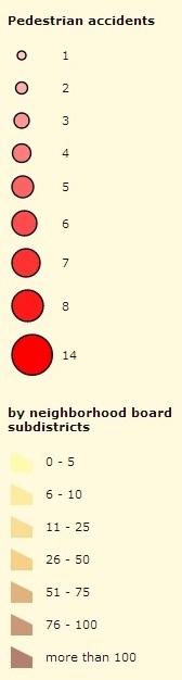
Click on a location to see the number of pedestrian accidents at that location.
Click on a subdistrict to see the total number of crashes for that subdistrict.
The data source for these locations are patient care reports completed electronically at the crash scene by City and County of Honolulu EMS providers. (This excludes reports submitted by EMS agencies for Hickam Air Force Base and Pearl Harbor Naval Base.) City and County personnel responded to 14,669 total crashes over the 5-year period, of which 14,121 (96%) could be mapped or geocoded.
Geocoding was accomplished by linking the patient care report to latitude and longitude recorded by the EMS Communications Center at the time of the 911 call. The crash “location” is therefore the location of the 911 caller, although this is assumed to usually be in the proximity of the actual crash. The crash location was plotted using Esri ArcGIS geographic information system software. Geocoded crash locations that were within 50 feet of each other were merged to a common final location, for a more manageable description of clusters.
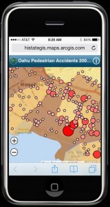
Click to view on a smartphone
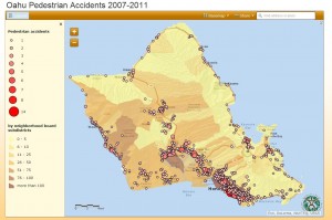
Click to view a larger map on desktop or tablet