New Crash Map will help determine the safety of the New King St. cycle track are valid.
Posted on Mar 10, 2015 in All IPCS News, City and County of Honolulu (Island of Oahu), reports maps data, traffic safetyNew Crash Map will help determine the safety of the New King St. cycle track are valid.
[facebook]
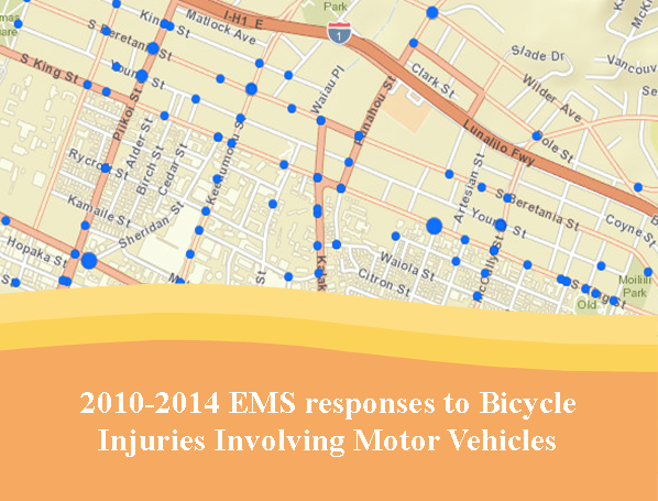
Current online crash map: https://bit.ly/crashmap
 Since 2008, IPCS began incorporating available geographic information location data captured from 911 callers into crash maps. Updated crash maps are available online through 2014 – https://bit.ly/crashmap
The intention of these crash maps are to help both the community advocates and decision makers determine locations that present possible risks for road users. Much of this type of information has helped mobilize community partners to support what we now know as Complete Streets: www.completestreets.org
Currently, the data is being used by community advocates and decision makers alike to take a fresh look at their travel routes and assess potential risk. Advocates behind the recently completed King Street Cycle track recognized the King Street Corridor as an area that would serve as a connector for bicyclists between Downtown and East Oahu. They pushed for a dedicated lane to improve visibility, encouraging bicyclists to move from riding on the sidewalk to riding along with traffic and reducing risk to bicyclists and pedestrians as well.
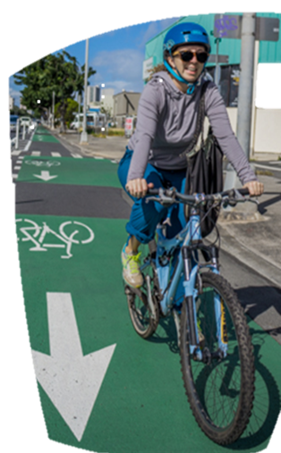
 With the mixed support behind the Cycle Track, I had to go see for myself what it was like. Prior to the installation of the Cycle Track, I would normally ride on makai shoulder alongside the parked cars and buses. If I was town bound, I would ride along Young St. and pray every time I crossed a “left yield on green” intersection.
So based on my initial experience of riding along the King Street Cycle Track here are my pros and cons:
Pros Bicycle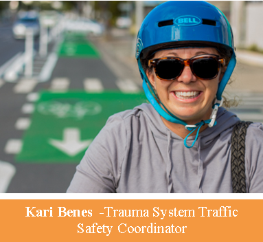 Rider:
Drivers are better positioned to see approaching bicyclists. Delineation between cyclist and driver adds a huge sense of security; stop lines for bicyclists position the rider out in front of the vehicles making left turns, which aids in visibility. Overall it’s a pleasant ride.
Cons Bicycle Rider:
There is uncertainty on how well prepared the drivers are to yield when approaching a bicyclist from behind. The rules regarding bicyclists riding against traffic have not yet been developed. Similar to other bicycle facilities, there is ambiguity regarding safe access leading to and away from the cycle track.
Pros Driver:
Green paint draws attention to the cyclist; fewer bicyclists are on the sidewalk; pedestrians are more visible approaching crosswalks to approaching drivers.
Cons Driver:
There is uncertainty regarding bicyclists behavior as they negotiate intersections.
It’s difficult to see on coming traffic coming out of driveways without partially blocking the cycle track.
Overall, I hope this type of road way improvement will be an impetus for all road users to look out for each other, and for decision makers to continually seek to provide solutions in making our roadways safe and enjoyable.
Kari Benes
EMS & Injury Prevention System Branch
Hawaii State Department of Health